VLS Series
Long Distance Series Product Model

Urban transportation faces a range of significant challenges, such as escalating traffic congestion, deteriorating traffic safety conditions, and pervasive traffic violations. The implementation of intelligent sensing technology holds the potential to significantly optimize traffic flow, bolster safety, alleviate congestion, and prevent traffic accidents, ultimately fostering the efficient and secure operation of urban transportation systems.
Utilizing Benewake's high-performance three-dimensional LiDAR, a multifaceted perception solution for urban intersections is proposed. This solution incorporates various sensor fusion, V2X, edge computing, and other advanced methods. By monitoring crucial information such as vehicle speed, vehicle trajectories, and road network operational status at urban intersections, it can accurately depict complex environmental scenarios. Benewake LiDAR provides a robust data foundation for logical intelligent transportation services, addressing the limitations of traditional perception technologies like cameras and millimeter-wave LiDAR, and laying the groundwork for enhanced future autonomous driving capabilities.
|
|
| ||
Ultra-High Resolution With 256 lines, the perception distance for traffic participants exceeds 150 meters | Wide FoV 120°×25.6°, with a minimum of 2 LiDAR units covering a standard intersection | Easy Fusion Synchronization clock accuracy can be achieved in the microsecond range with various time synchronization methods such as gPTP, NTP, and PTP, supporting spatial fusion of up to 2 million points per second | ||
|
|
| ||
Gaze Function Fully adjustable across the entire field of view, doubling the resolution in key areas | Fine Target Perception Centimeter-level positioning accuracy, supporting multiple perception types | Digital Platform Multi-sensor fusion for panoramic perception, facilitating applications on upper platforms and point cloud mapping |
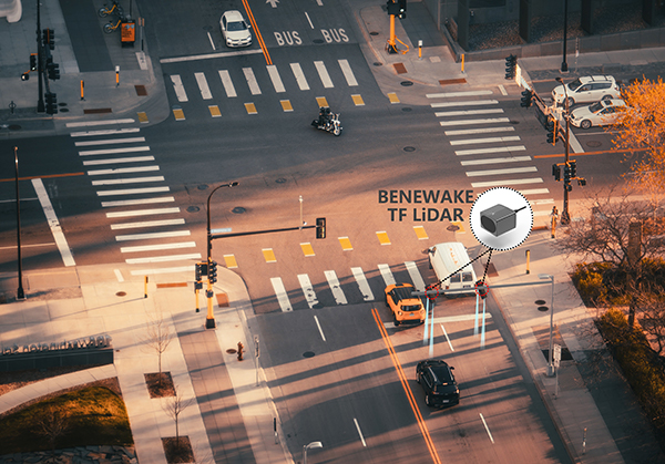
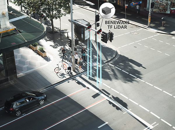
Benewake's LiDAR, with its powerful and stable performance, can be applied to various types of roads to achieve vehicle flow and speed detection, assisting in upgrading road traffic signal control systems, effectively improving road traffic efficiency.

The measurement module of this solution consists of two Benewake single-point LiDARs. Based on the LiDAR measurement data, the passing state of vehicles is determined and real-time traffic flow information is calculated. At the same time, the vehicle speed can be calculated by recording the trigger time of the two LiDARs.

1. The accuracy of traffic flow statistics is over 99%.
2. Optical detection is not affected by 3G/4G wireless signals or Wi-Fi signals from communication operators at intersections, with strong anti-interference ability and stable performance.
3. It has strong environmental adaptability and can measure stably in strong ambient light and at night without additional equipment (such as a light source).
4. With high-frequency detection, it is suitable for high-speed scenes, and can detect vehicle speeds up to 150 km/h.
5. Non-contact detection avoids high failure rates caused by frequent vehicle crushing and has low after-sales costs.
6. It is easy to install and does not require damaging the road surface.
Utilizing Benewake's high-performance three-dimensional LiDAR, A solution offers comprehensive tracking of targets, including their ID, speed, type, heading angle, and trajectory. It accurately portrays lanes, the surrounding environment, and queue lengths on a point cloud map. The solution supplies high-grade perception data for V2X applications, leveraging multi-point LiDAR fusion to create a comprehensive 3D map of intersections. It captures the intricate relationships between scenes and targets, enabling precise lane representation, environmental portrayal, and queue length detection.
Furthermore, Benewake's LiDAR technology offers precise, stable, and dependable traffic flow perception data for holographic intersection applications, thereby enhancing holistic situational awareness in road traffic. For traffic light control applications, it fulfills the traffic management department's requirements for dynamic analysis and intelligent urban traffic scheduling.

Point Cloud Effect - 4 LiDARs Stitched Together

Point Cloud Effect - Single LiDAR
Beijing Development Zone Intersection Project

Intersection Installation Effect
Chengdu Signal Light Control Project

Intersection Installation Effect