


Headquarters:3rd Floor, Haiguo Jiaye Sci-Tech Park, Haidian District, Beijing, China

We use cookies to enhance your browsing experience and serve personalized content.
Reject ALL
Accept ALL


2025-11-25
Customer: Meituan-Keeta Drone
Applications: Autonomous Take-off and Landing, Cruising, Hovering
400,000+ deliveries completed in China with 99.98% altitude stability.
Dubai’s first licensed BVLOS drone fleet achieves 84% lower emissions than trucks.
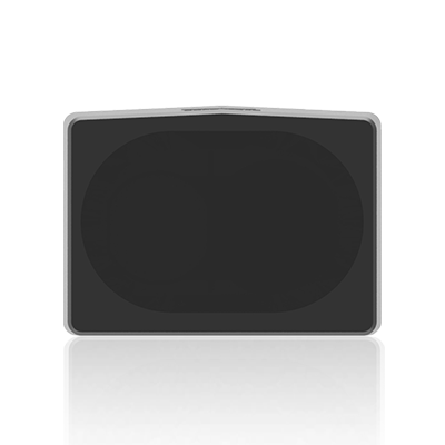
Largest Market-Proven: TF03 has been verified in various scenarios and has passed the DO-160G certification
Suitable for diverse drones: TF03's 7000Hz detection frequency enables compatibility with various drone speeds.
Meituan, a leader in China’s technology and retail sectors, is revolutionizing the delivery industry with its innovative drone services, completing over 400,000 deliveries across the country’s largest cities. Through its subsidiary, Keeta Drone, Meituan aims to enhance customer experience and improve logistics efficiency by leveraging advanced technologies to overcome the limitations of traditional delivery methods.
Keeta's drone deliveries prioritize speed and convenience while also focusing on sustainable logistics. With a load capacity of up to 2.5 kg, these drones can transport common meals, small packages, and certain emergency medications.

In Dubai's operational areas, like in Dubai Silicon Oasis (DSO) where medicines and food are delivered across 4 routes with estimated times of arrival (ETAs) of less than 12 minutes, traditional delivery methods struggled with long wait-times caused by traffic congestion and complex routes. After adopting drone delivery, the delivery time has been cut to one-third or even less of the original, boosting delivery efficiency by over 60%.
Urban Complexity: Dubai's 800+ high-rises create GPS signal interference, leading to altitude drift and navigation failures. Additionally, operating Beyond Visual Line of Sight (BVLOS) in areas prone to sandstorms presents further challenges.
Environmental Extremes: Desert temperatures (up to 50°C) and sandstorms degrade traditional sensors, risking unstable flight paths.
Operational Costs: A single altitude error can lead to delayed deliveries, damaged payloads, or even regulatory penalties.
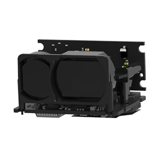
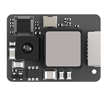
Understanding the unique challenges of urban air traffic, the Meituan-Keeta drone integrates a compact LiDAR module, enabling it to maintain altitude precision within centimeters without relying on GPS during takeoff and landing. The innovative algorithm compensates for sudden wind gusts and payload shifts, ensuring stability and reliability throughout the flight. Drones can safely navigate the narrow spaces between skyscrapers by combining LiDAR with IMU and vision systems through multi-sensor fusion. Additionally, the LiDAR system demonstrates excellent thermal resilience, allowing for seamless operation in Dubai's 50°C heat for 24/7 service.
Ready to Elevate Your Drone Performance? The Future of Urban Air Mobility Starts Here
Explore Benewake’s LiDAR solutions for other drone applications.
|
|