VLS Series
Long Distance Series Product Model

2025-08-11
Lightweight LiDAR sensors represent a groundbreaking advancement in modern drone detection technology. Mounted on UAVs, these sensors enable precise distance measurement by emitting near-infrared laser pulses and analyzing the backscattered signals from target objects. Even in challenging environments with complex terrain or poor visibility, drones with LiDAR can preserve stable flight operations while achieving superior mission efficiency and operational reliability.

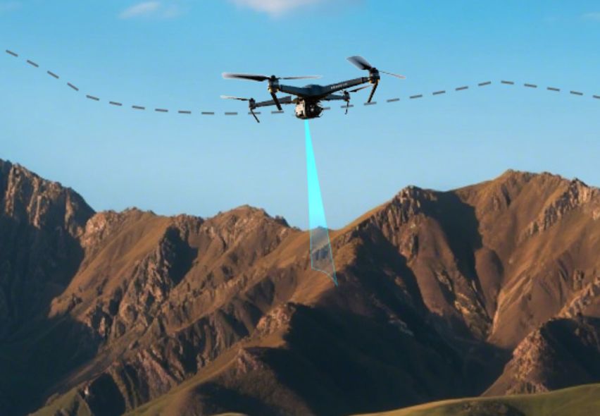
The LiDAR sensor for drones can continuously calculate the distance between the drone and the ground or other reference surfaces. By providing real-time altitude data, it empowers the drone's flight control system to make immediate adjustments, ensuring that the drone stays at the desired height even when encountering air currents or uneven terrain. This stability is vital for applications such as aerial photography, surveying, and inspection, where consistent altitude guarantees the quality and accuracy of the collected data.
Precision hovering aids drones in upholding stable positioning at specific locations, which is critical for tasks such as detailed inspections, material delivery, or search and rescue operations. LiDAR-equipped UAVs can achieve centimeter-level positioning accuracy. By detecting minute positional deviations, the LiDAR sensor for the drone continuously returns precise feedback to the flight controller, which dynamically adjusts rotor speeds to maintain exceptional mid-air stability.
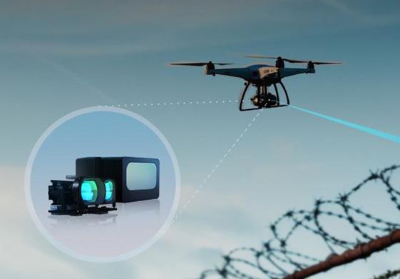
Obstacle avoidance is a critical safety feature for drones, preventing collisions with buildings, trees, and other objects, thereby avoiding property damage or even casualties. LiDAR sensors for drones can detect objects at an extremely high frequency, quickly perceiving changes in the dynamic environment. When multiple lightweight sensors are combined to form a 360° adaptive detection system, it significantly enhances flight safety in complex environments, such as dense urban areas and forests, while boosting the efficiency of tasks like logistics, inspection, and emergency rescue.
Drones encounter multiple landing challenges: potential uneven terrain and obstacles such as debris, vegetation, or even moving platforms. An improper landing could damage critical components (e.g., airframe, rotors), leading to costly repairs or total loss, while also posing risks to ground personnel and property.
The LiDAR sensor for drones can deliver millimeter-accurate, real-time altitude data. During final approach, it constantly monitors the drone's exact ground clearance, permitting the flight control system to execute gentle, precision touchdowns, effectively eliminating impact damage caused by altitude miscalculations.
By integrating a lightweight LiDAR with a downward-mounted configuration, drones gain real-time terrain-following or terrain-sensing capability. This empowers the drone to take appropriate measures to sustain a constant altitude relative to the ground. which is crucial for applications such as agriculture and surveying.
Traditional logistics systems are often slow and inefficient due to traffic congestion and suboptimal routes. Drone delivery, however, is not only more efficient but can also access hard-to-reach locations that traditional logistics cannot. The LiDAR sensor for drones helps avoid obstacles and identifies safe delivery spots. Even when encountering external disturbances such as strong wind gusts, the drones can keep stable hovering for precise package delivery, significantly improving delivery safety and reliability.
2. Gimbal Rangefinding
Detection accuracy is a core metric for evaluating LiDAR sensors for drone performance. It defines whether a drone can precisely identify and locate obstacles. High-accuracy LiDAR sensors ensure reliable environmental data acquisition in complex operational scenarios. Factors such as laser beam quality, signal processing algorithms, and calibration can all impact detection accuracy
The weight of the UAV LiDAR sensor directly impacts the flight time and payload capacity. A lighter sensor reduces the drone's overall load, thereby extending flight duration or facilitating the carrying of heavier mission-specific equipment (e.g., high-resolution cameras, cargo).
The frequency refers to the number of laser pulses emitted per second, which determines the data update rate. A higher frequency means the sensor can capture more frequent distance readings within a given time, improving its ability to track rapid changes in the environment.
In adverse weather conditions (rain or fog), interference can affect sensor performance. Robust anti-interference capabilities ensure drones can obtain reliable data, enhancing safety during flight.
The range of a LiDAR sensor for drones specifies the farthest operational limit for target detection. A flexible range allows for various applications: shorter ranges are sufficient for close inspections, while longer ranges support early detection of obstacles, providing ample time for reaction and path planning.
1. TF-Luna
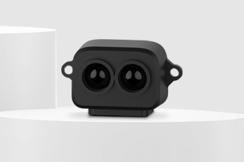
The TF-Luna LiDAR sensor is a powerful solution for drones with strict payload and power limitations. Weighing under 5 grams and consuming less than 0.35W, it significantly boosts drone performance. With a precise single-point range of 0.2-8 meters and 1cm resolution, its adaptive algorithms and configurable settings ensure consistent accuracy in various conditions.

2. TFA300-L
The TFA300-L features a high frequency of up to 10,000 Hz. In applications such as EO/IR gimbals, SAR drones, and high-speed FPV racing drones, it supports automatic camera focus adjustment, precise positioning, stable altitude hold during cruising, and obstacle avoidance during high-speed flight.
The LiDAR sensor is fully optimized for complex drone applications, including operation in extreme temperatures, 100 KLux ambient light, and harsh outdoor conditions like rain, fog, and dust. Effectively solving the common false-positive issues seen with traditional LiDAR systems.
Additionally, this LiDAR sensor for drones can be connected directly to a flight control platform without an adapter, realizing plug-and-play compatibility.

As drones continue to revolutionize industries from logistics and agriculture to security and infrastructure inspection, LiDAR sensors have become an indispensable component for achieving flight precision, environmental awareness, and mission safety.
Our Benewake advanced LiDAR solutions are engineered to meet the evolving needs of drone applications, offering the balance of reliability, performance, and affordability. Contact our team to find the best-fit solution for your UAV projects.